Posts

Showing posts with the label geodetic

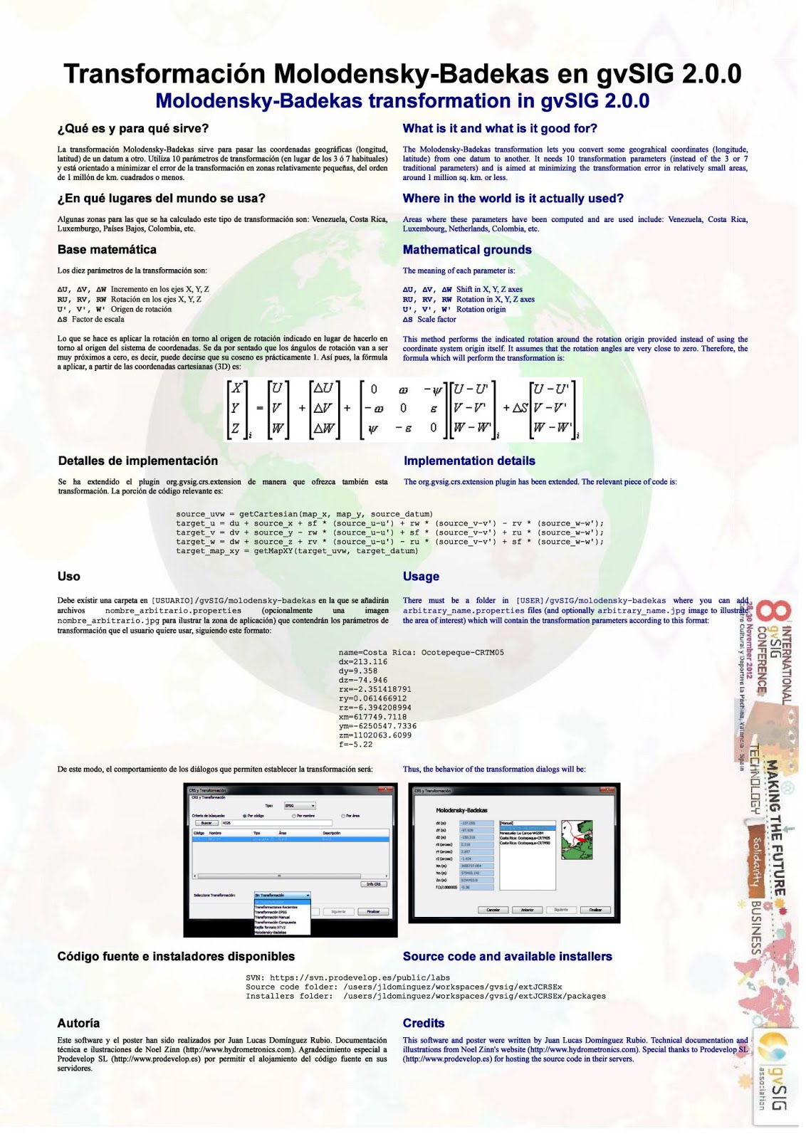
Molodensky-Badekas transformation in gvSIG 2.0.0
Image
What? Providing a way to perform the 10-parameter Molodensky-Badekas transformation (useful in the Netherlands, Venezuela, Costa Rica, etc.) How? Extending the extJCRS plugin, by providing the missing computations in pure Java. Usage? User provides text file with parameters and optionally an image to illustrate area of interest. Show me! Click image to enlarge or get poster in [PDF] and [OpenOffice] formats.

El orden de los ejes en los CRS de EPSG

Ojeando la web http://www.epsg-registry.org y las explicaciones de la especificación OGC WMS 1.3.0 , se deduce que las nuevas versiones de los protocolos y formatos de OGC (WMS, WFS, GML, etc) van a respetar rigurosamente las especificaciones de EPSG en lo que se refiere al orden en el que se colocan las coordenadas (es decir, si se coloca antes la X ó la Y, o bien si se coloca antes la longitud o la latitud). El resumen es este: Para CRS geográficos (coordenadas en grados) se usará siempre el orden [latitud, longitud]. Ejemplos: EPSG:4326 (datum WGS84), EPSG:4258 (datum ETRS89), EPSG:4230 (datum ED50). Para CRS proyectados (coordenadas generalmente en metros) se usará por lo general el orden [E, N], donde "E" significa "Eje en la dirección este-oeste" y "N" significa "Eje en la dirección norte-sur". Este orden es el "tradicional" que solemos llamar "X, Y". Ejemplos: EPSG:32630, EPSG:23030, etc. Excepcionalmente, algunos...

You don't need it every day but hey, looks nice!

Image
The 1,000-km buffer on a meridian in EPSG:4326 (WGS84) looks like this:

A fast pseudo-projection can save you time when processing small features

Image
In geodetic (lat/lon) coordinate systems such as EPSG:4326, we can assume that proportions between vertical (N-S) distances are preserved, while horizontal (W-E) distances are strongly distorted, as shown here: Thus, an area or object which is a perfect square in the real world (let's assume it's a small object) will appear as a rectangle in EPSG:4326. In the geodetic coordinate system, all parallels are as long as the Equator, but we know their true length is approximately: L = E *  cos( lat ) where E is the length of the Equator, so our rectangle (a square in the real world) will have an estimate ratio (height divided by width) of  cos( lat ) . If we have a large vector layer that consists of many small features (lines or polygons) and we need to perform a geoprocess to each one (such as buffering or some trigonometric computation) we can use a faked projection, which consists in scaling the feature in one of the two axes: Multiply the X (longitude) of each ver...